Project Highlight | River Red Gum Precinct (Stage 2 Infrastructure)
Masterplanning Ecological Infrastructure and Place-Based Resilience in Northern Glenroy
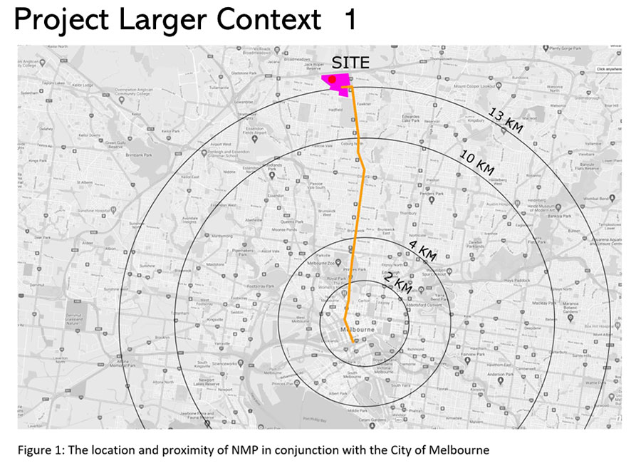
The River Red Gum Precinct Stage 2 Infrastructure Masterplanning Project represents a pivotal step in Glenroy’s transformation into a restorative urban memorial landscape. Developed in the context of broader strategic plans—co-designed with Merri-bek City Council and key stakeholders—this initiative integrates water-sensitive urban design, climate-responsive modelling, and inclusive access planning while preserving long-term product yield capacity.
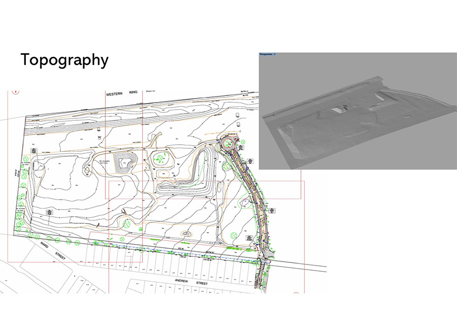
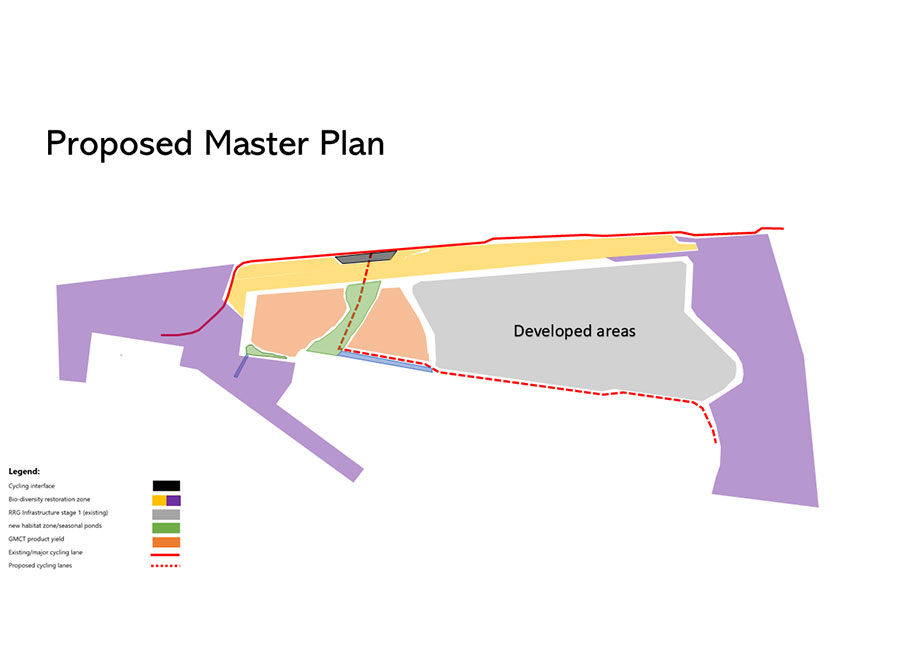
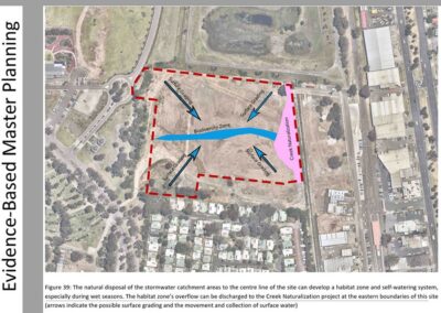
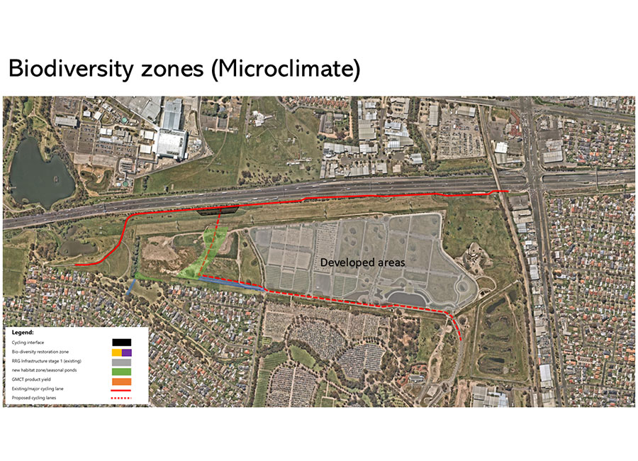
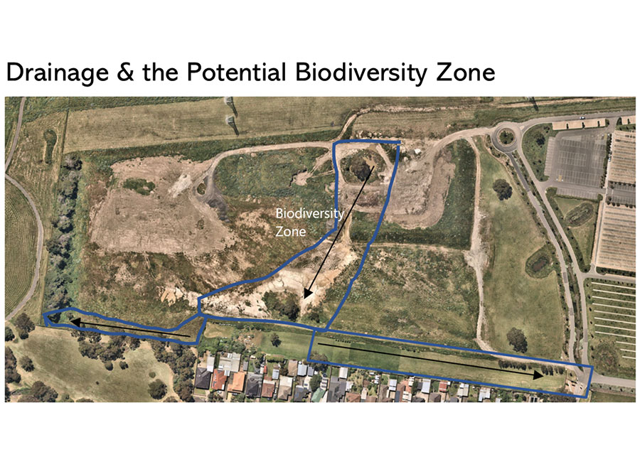
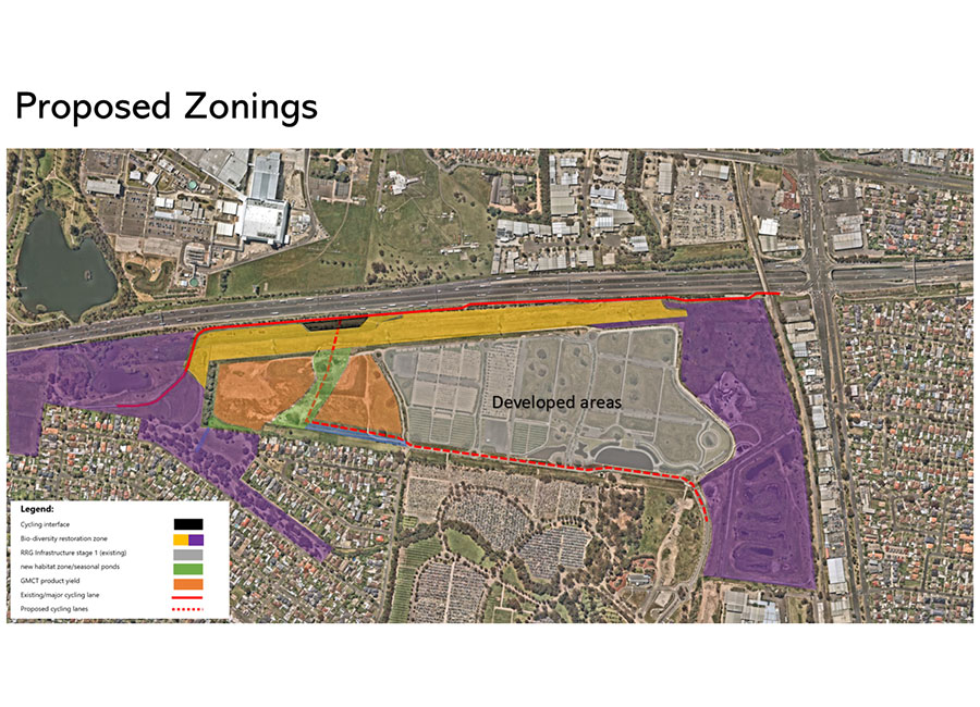
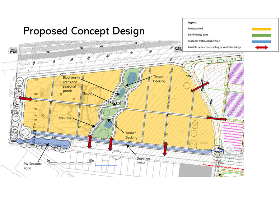
At its core, the design employs evidence-based modelling and ecological intelligence to shape a sustainable, community-oriented landscape. A central biodiversity and habitat zone is framed by recycled spoil mounds, establishing both functional and symbolic landscape logic. This multi-layered framework enhances ecological connectivity, passive recreation, and spatial dignity.
Services Delivered:
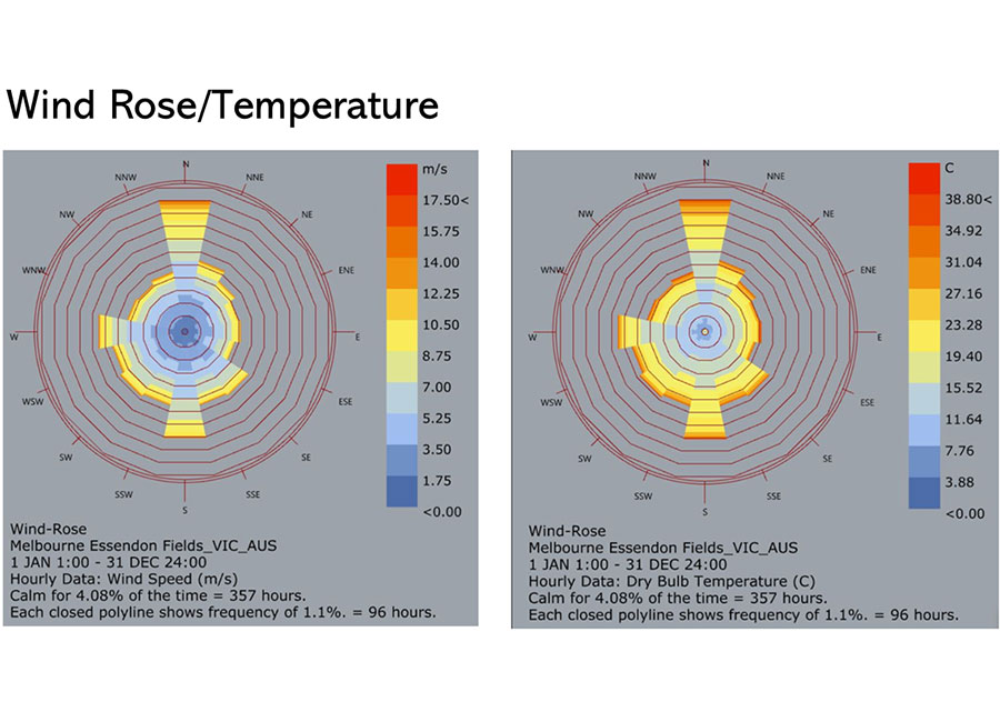
- Generative design strategies informed by Rhino-based solar, wind, and stormwater modelling.
- Habitat restoration and ecological corridor reconnection at the urban fringe.
- Reuse of spoil material for landform creation to moderate microclimates and define place.
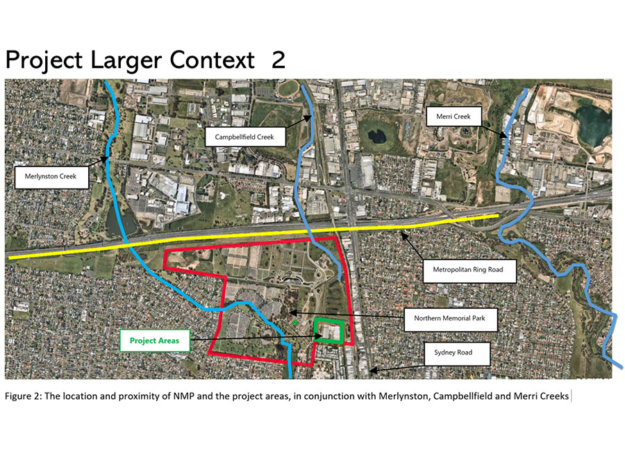
- Integrated water infrastructure linking new drainage with existing swales and Merlynston Creek.
- Outdoor gathering spaces including amphitheatre-grade ceremonial zones.
- Multimodal access planning (pedestrian, cycling, vehicular) with passive surveillance design.
- Climate-resilient planting design adapted to diverse micro-zones.
- Stakeholder engagement and return brief development to inform detailed design.
Project Overview
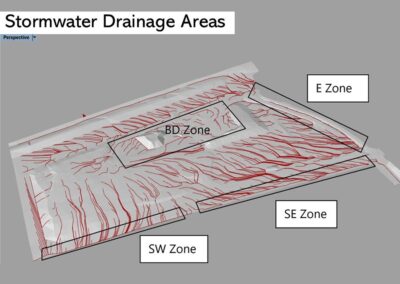
This project embodies GMCT’s commitment to civic-scale, future-resilient memorial infrastructure. Using Rhino to simulate environmental conditions, the design identifies four primary stormwater catchments that frame a central habitat corridor. Angled linear mounds mitigate dominant wind patterns, while native planting supports local ecology and visitor comfort.
Visitor infrastructure—including shaded rest nodes, bike repair stations, and pedestrian bridges—promotes year-round access and engagement. Interfaces with the Metropolitan Ring Road bike path and adjacent public green spaces ensure seamless integration into Glenroy’s wider urban framework.
Product yield areas are strategically located to balance visual amenity, accessibility, and long-term operational flexibility. Soil-specific planting palettes will be developed with input from specialist consultants to maximise ecological performance and landscape resilience.
This project sets a new benchmark for place-based, data-informed cemetery design in metropolitan Melbourne.


Design: Hamed Tavakoli (Meso Space)
Site: Glenroy, Victoria (GMCT)
Year: 2024–2026 (Concept and Detail Design Phase)