

In Brief
Australia’s bushfire system still runs on reaction: firefighting, evacuation and recovery. Predictive bushfire planning offers a different approach it maps how vegetation fuel ages across a landscape over time, not just how much fuel exists. A method called Fuel Age Gap Mapping uses satellite data to find where fuel ages are converging into dangerous, continuous fire pathways, years before a fire starts. This article explains why landscape-scale planning, not just building codes, needs to lead the next phase of bushfire risk management.
Catastrophic bushfires keep overwhelming Australian communities despite decades of planning controls, hazard-reduction programs and increasingly sophisticated fire danger warnings. The Victorian Bushfires Royal Commission made the reason clear: bushfire disasters are not only natural events. They are also failures of land-use planning, fuel management coordination and long-term risk governance (Teague et al., 2010).
Predictive bushfire planning asks a different question than most current frameworks. Instead of preparing to respond once conditions turn dangerous, it asks whether we can see risk building in the landscape years in advance.
Strong Design Rules, Weak Landscape Patterns
Australia already runs a sophisticated regulatory framework for bushfire risk. Bushfire Attack Level (BAL) ratings govern building construction. Bushfire Prone Area (BPA) mapping identifies exposed zones. Asset Protection Zones (APZs) create buffers around properties. Prescribed burning programs treat fuel load. Fire danger indices track weather-driven risk. Local planning overlays and building standards round out the system.
These tools have genuinely improved building resilience and emergency response capacity (Bradstock et al., 2012). But they share one critical limitation: they protect assets at the point of impact rather than reshaping landscapes before risk escalates.
BAL levels regulate how a house gets built under assumed fire exposure. They say nothing about how the surrounding vegetation ages over time. APZs create buffers at the lot scale but rarely coordinate fuel management across a region. Agencies typically report prescribed burns in hectares treated, not in whether landscape-wide fuel age patterns are becoming safer or more dangerous.
Planning is strong at the building scale. It is weak at the landscape scale and that gap is exactly where predictive bushfire planning needs to operate.
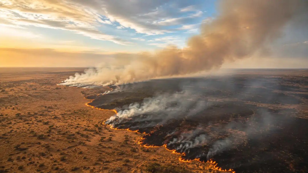
Why Current Systems Stay Reactive
Most bushfire risk frameworks run on two variables: weather (temperature, wind, humidity) and fuel load (how much vegetation exists). Fire danger indices warn when conditions turn dangerous. Prescribed burning reduces fuel in selected locations. Neither variable directly tracks how fuel ages and accumulates across space and time.
Here is the core weakness: most systems treat vegetation as static. Landscapes get mapped spatially but rarely temporally, even though research shows fire behaviour depends strongly on vegetation age and continuity, not simply fuel quantity (Gill & Zylstra, 2005).
Prescribed burns implemented parcel by parcel, year by year, can unintentionally synchronise fuel ages across large regions. Entire landscapes mature together into highly flammable systems, forming continuous fire pathways (Boer et al., 2020). Local risk reduction can therefore translate into regional vulnerability. Land managers may be managing fuel locally while increasing risk systemically.
Remote Sensing Alone Is Not Predictive Bushfire Planning
Satellite imagery has transformed bushfire science. NDVI and related indices now map burn scars, vegetation recovery, drought stress and fire severity.
Most of these applications remain descriptive rather than predictive, though. They show where fires already occurred or where vegetation is currently stressed. They do not show how a landscape is evolving toward a dangerous spatial configuration. Remote sensing has helped researchers understand the past. Planning systems have not yet fully integrated it to forecast emerging risk patterns across landscapes (Parks et al., 2016).
Fuel Age Gap Mapping: A Predictive Planning Method
Fuel Age Gap Mapping reframes bushfire risk as a spatial-temporal pattern problem, not a single hazard variable. Its central premise is simple: bushfires become catastrophic not because vegetation grows old, but because it grows old together.
Using time-series satellite imagery from Sentinel-2 or Landsat, GIS analysis can estimate the approximate year of the last disturbance for each pixel. This works by detecting sharp drops in vegetation indices and cross-referencing historical fire-scar datasets (Parks et al., 2016). Vegetation recovery then gets grouped into broad fuel-age classes typically 0–3 years, 3–7 years, 7–12 years, and 12-plus years. Precision is not the goal here. Pattern recognition is.
Mapping Variance, Not Just Fuel Age
Rather than mapping fuel age alone, this predictive bushfire planning method calculates variance across neighbourhoods of the landscape using moving-window GIS analysis.
Low variance signals dangerous homogeneity large areas of vegetation share the same age and can burn intensely together. High variance signals a safer mosaic pattern, where a mix of vegetation ages slows fire spread and reduces intensity.
The output is a pattern map, not a fuel map. It shows fuel plateaus (continuous mature vegetation), fuel breaks (diverse age mosaics), and emerging corridors of risk where those gaps are closing. That makes risk visible years before extreme weather arrives.

From Reactive to Proactive Intervention
Fuel Age Gap Mapping enables targeted intervention rather than blanket treatment across an entire region. Land managers can intervene specifically where fuel age gaps are collapsing, using controlled low-intensity burns, cultural burning led by Traditional Owners, strategic grazing, mechanical thinning, pre-designed mineral earth breaks in extreme-risk zones, or pre-authorised clearance actions triggered ahead of forecast heatwaves.
These actions do not wait for a fire danger day. Land managers can schedule them ahead of a predicted convergence between fuel age patterns and extreme weather risk. This approach complements Indigenous fire knowledge, which has long emphasised patchiness, timing and relational land stewardship over uniform fuel removal (Russell-Smith et al., 2003).
Limits, Risks and Governance Questions
Fuel Age Gap Mapping needs cautious, informed application. Satellite-derived fuel age is a proxy, not a direct measurement. NDVI reflects greenness, not fuel structure. Rainfall variability can distort recovery curves, and understory fuels remain difficult to detect remotely.
A governance risk also exists. Turning fuel age into a rigid regulatory metric could create technocratic systems that sideline community and Traditional Owner decision-making. This method should function as a decision-support layer, not a command system one that complements ecological knowledge, cultural burning and local land stewardship rather than replacing them. Innovation without humility creates new blind spots.
Why Landscape Planning Must Lead the Next Phase
Australia cannot suppress its way out of climate-driven fire risk. Longer fire seasons and higher temperatures demand tools that operate years before ignition, not hours before catastrophe. The next phase of bushfire prevention needs to become predictive rather than reactive, landscape-based rather than lot-based, and planning-led rather than emergency-led.
Mapping fuel age gaps reframes bushfire risk as a design and planning problem, not only a firefighting problem. If land managers can see where landscapes are ageing together, they can act before those landscapes burn together.
Frequently Asked Questions
What is predictive bushfire planning? Predictive bushfire planning is an approach that identifies bushfire risk before extreme weather arrives, by analysing how vegetation fuel ages and accumulates across a landscape over time, rather than only responding once fire danger conditions occur.
What is Fuel Age Gap Mapping? Fuel Age Gap Mapping is a GIS-based method that uses satellite imagery to track vegetation age across a landscape and identify where fuel ages are converging into large, continuous, high-risk zones.
How is this different from existing bushfire risk tools like BAL ratings or APZs? BAL ratings and Asset Protection Zones manage risk at the building or lot scale. Predictive bushfire planning operates at the landscape scale, identifying how fuel age patterns evolve across an entire region over years, not just at a single property boundary.
Can Fuel Age Gap Mapping replace prescribed burning or cultural burning programs? No. It is designed as a decision-support layer that helps land managers target interventions such as prescribed burns, cultural burning and mechanical thinning more precisely not a replacement for those practices or for Traditional Owner-led land management.
Who would use predictive bushfire planning tools? Councils, government land management agencies, Parks Victoria and similar public-sector bodies, and cemetery trusts or other organisations managing large-scale landscapes in bushfire-prone areas, can use this approach to plan interventions ahead of fire seasons.
Talk to Mesospace About Landscape-Scale Bushfire Planning
If your council or agency needs a landscape-scale approach to bushfire risk, Mesospace can help you move from reactive fuel management to predictive bushfire planning grounded in evidence and systems thinking.
About the Author
Dr. Hamed Tavakoli is the founder of Mesospace, a landscape architecture and urban design practice working at the intersection of evidence-based design, strategic planning and systems thinking. His work applies GIS analysis and landscape ecology to help councils and government agencies plan for bushfire risk, cemetery capacity and long-term public asset resilience across Australia.
References
Boer, M. M., Resco de Dios, V., & Bradstock, R. A. (2020). Unprecedented burn area of Australian mega forest fires. Nature Climate Change, 10(3), 171–172. https://doi.org/10.1038/s41558-020-0716-1
Bradstock, R. A., Cary, G. J., Davies, I., Lindenmayer, D. B., Price, O. F., & Williams, R. J. (2012). Wildfires, fuel treatment and risk mitigation in Australian eucalypt forests: Insights from landscape-scale simulation. Journal of Environmental Management, 105, 66–75. https://doi.org/10.1016/j.jenvman.2012.03.050
Gill, A. M., & Zylstra, P. (2005). Flammability of Australian forests. Australian Forestry, 68(2), 87–93. https://doi.org/10.1080/00049158.2005.10674951
Parks, S. A., Miller, C., Abatzoglou, J. T., Holsinger, L. M., Parisien, M. A., & Dobrowski, S. Z. (2016). How will climate change affect wildland fire severity in the western US? Environmental Research Letters, 11(3), 035002. https://doi.org/10.1088/1748-9326/11/3/035002
Russell-Smith, J., Yates, C. P., Edwards, A. C., Allan, G. E., Cook, G., Cooke, P., Craig, R. L., Heath, B., & Smith, R. J. (2003). Contemporary fire regimes of northern Australia, 1997–2001: Change since Aboriginal occupancy, challenges for sustainable management. International Journal of Wildland Fire, 12, 283–297.
Teague, B., McLeod, R., & Pascoe, S. (2010). Victorian Bushfires Royal Commission Final Report. Government of Victoria. http://royalcommission.vic.gov.au/finaldocuments/summary/PF/VBRC_Summary_PF.pdf